


Voting District 0205, Limestone County, Texas
About
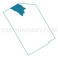
Outline

Summary
| Unique Area Identifier | 675483 |
| Name | Voting District 0205 |
| County | Limestone County |
| State | Texas |
| Area (square miles) | 54.40 |
| Land Area (square miles) | 53.78 |
| Water Area (square miles) | 0.62 |
| % of Land Area | 98.87 |
| % of Water Area | 1.13 |
| Latitude of the Internal Point | 31.74032270 |
| Longtitude of the Internal Point | -96.72903760 |
Maps


Graphs
Select a template below for downloading or customizing gragh for Voting District 0205, Limestone County, Texas


Neighbors
Neighoring Voting District (by Name) Neighboring Voting District on the Map
- Voting District 0023, Hill County, TX
- Voting District 0024, Hill County, TX
- Voting District 0203, Limestone County, TX
- Voting District 0204, Limestone County, TX
- Voting District 0206, Limestone County, TX
Top 10 Neighboring County Subdivision (by Population) Neighboring County Subdivision on the Map
- Hubbard-Mount Calm CCD, Hill County, TX (2,579)
- Coolidge CCD, Limestone County, TX (1,302)
- Prairie Hill CCD, Limestone County, TX (878)
Top 10 Neighboring Place (by Population) Neighboring Place on the Map
Top 10 Neighboring Unified School District (by Population) Neighboring Unified School District on the Map
- Mexia Independent School District, TX (11,516)
- Groesbeck Independent School District, TX (9,644)
- Hubbard Independent School District, TX (1,960)
- Coolidge Independent School District, TX (1,422)
- Mount Calm Independent School District, TX (769)